AUGUST 28, 2007 — Before my brother Brian and I began our backpacking and camping trip in Denali National Park and Preserve last week, we read with disbelief in Lonely Planet Alaska that the average Denali backcountry hiker averages only five miles per day, and more people have been killed by drowning in the park’s freezing rivers than by the sizeable grizzly bear population (in fact, no one has ever been killed by a bear in Denali). We didn’t understand. Though we were a little worried that Denali sounded strangely like a Bermuda Triangle where people walked at half-speed and rivers could swallow humans whole, we didn’t pay much attention. Accustomed to hiking well over 10 miles per day on other hikes, we planned a five-day, 55-mile trip, packed meticulously well-stocked backpacks with extra meals for safety, and braced ourselves for the most challenging wilderness adventure of our lives.
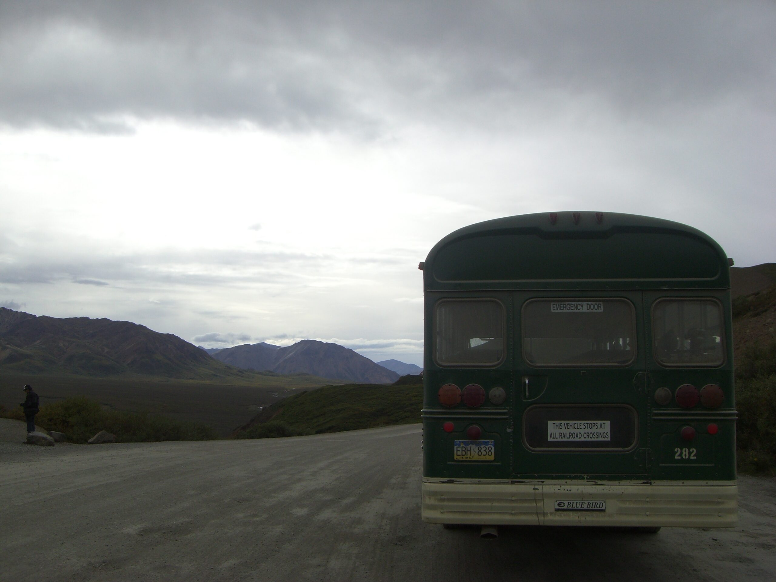
The Denali Park shuttles look like school buses stolen by Smokey the Bear.
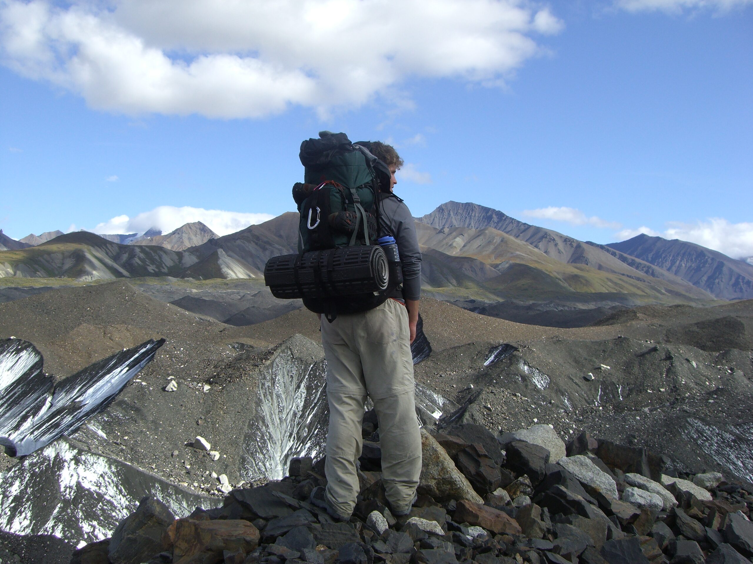
We began at Wonder Lake, a campground deep in the heart of the park, which served as a perfect jumping-off point for our excursion. Even our trip to the lake wasn’t easy; to get there, we flew into Anchorage, drove six hours in a rental car to the entrance of the park, and then hopped on one of the park’s school-bus style shuttles to complete the additional six-hour drive through the park to the Lake. When we finally arrived, we donned our 45-pound backpacks and bounded into the backcountry.
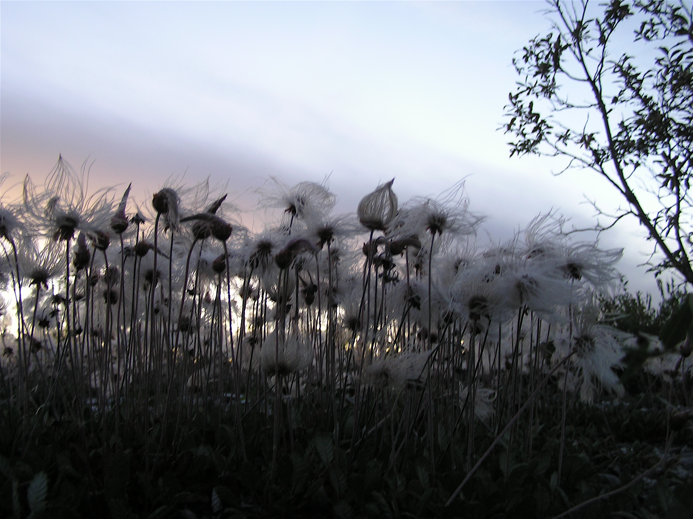
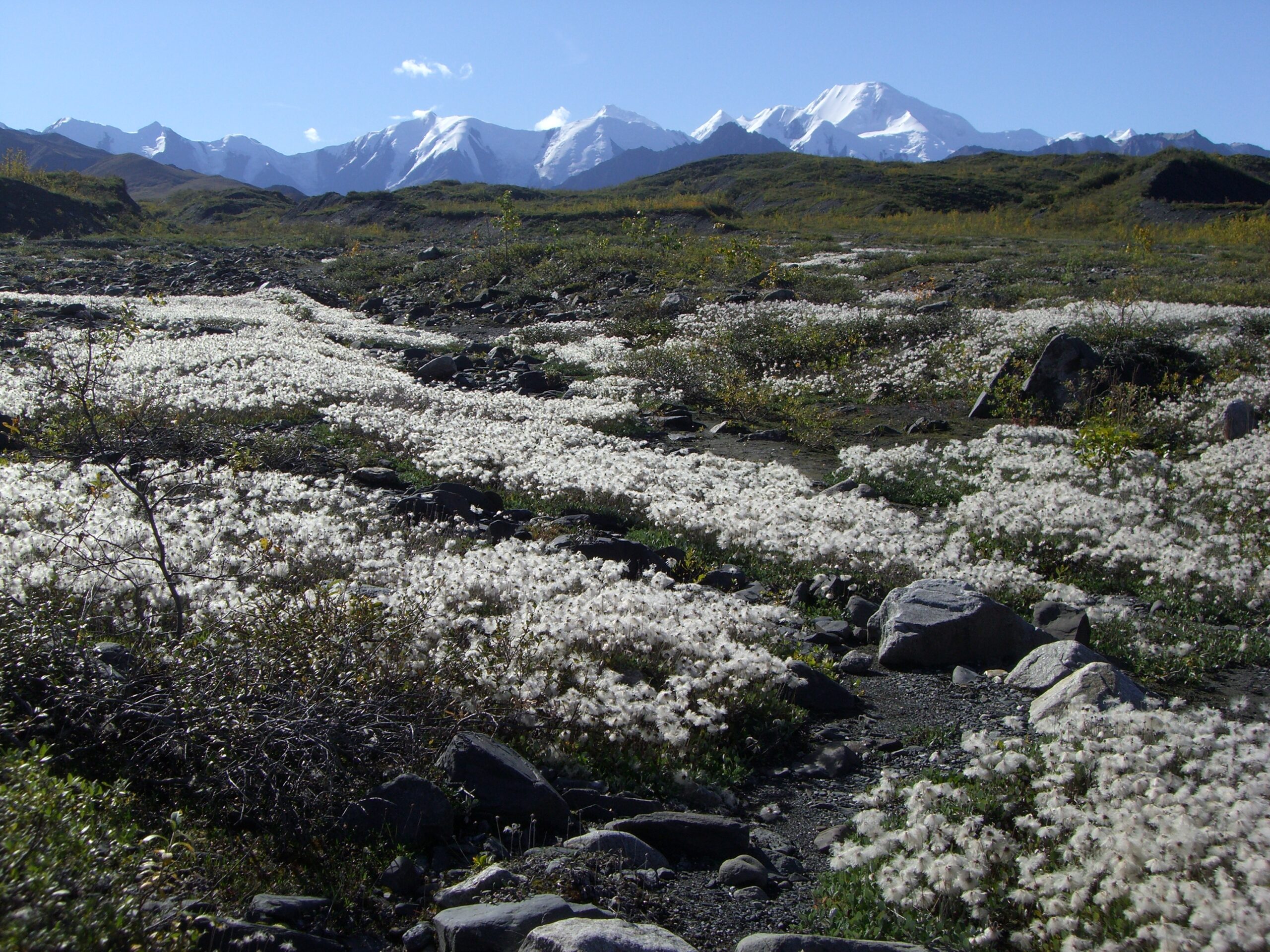
Beautiful flowers cover the Alaskan backcountry.
Our itinerary, one we borrowed from Peter Potterfield’s Classic Hikes of the World and then expanded, included a number of major obstacles (our personal twelve trials, we joked), the first of which was the McKinley River, which separates Wonder Lake from the park’s southern half. In some areas, the river is more than a mile wide and over ten feet deep, and because the river is glacially-fed, the water temperature hovers near freezing. Often, the river is completely impassable, and when we arrived at the park, a ranger told us it would be nearly impossible for us to cross it. But we had our hearts set on a trip that followed an old mountaineering trail leading to the base of the astounding, 20,320 foot-high Mount McKinley, and that necessitated our crossing the river. The ranger told us that if we had “extensive river crossing experience” (who has that?!) and were “really committed,” we could wake up at 3 o’clock in the morning and attempt to cross the river at first light when the water-level was lowest. In retrospect, we probably should have realized that “really committed” meant a lot more than simply waking up early in the morning.
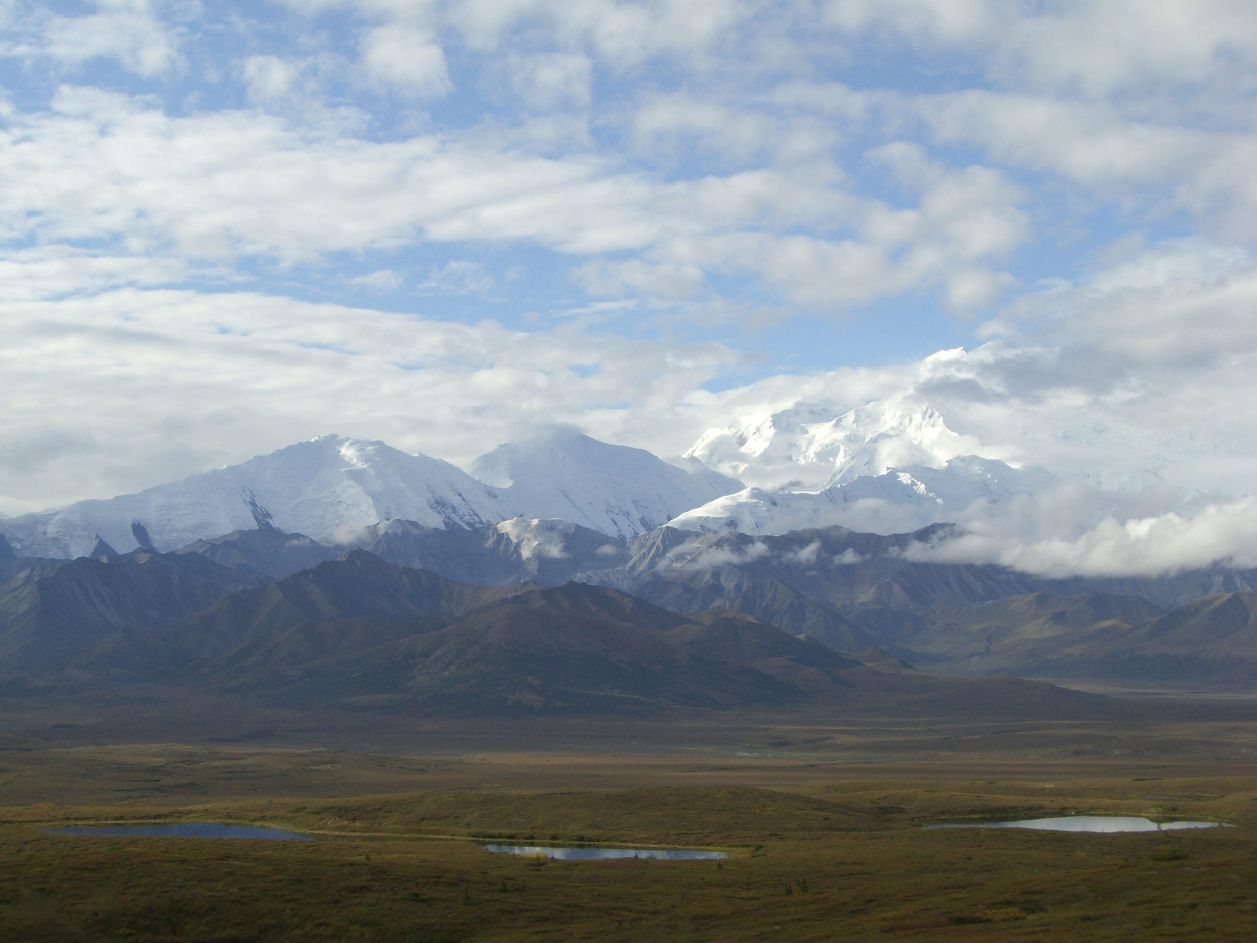
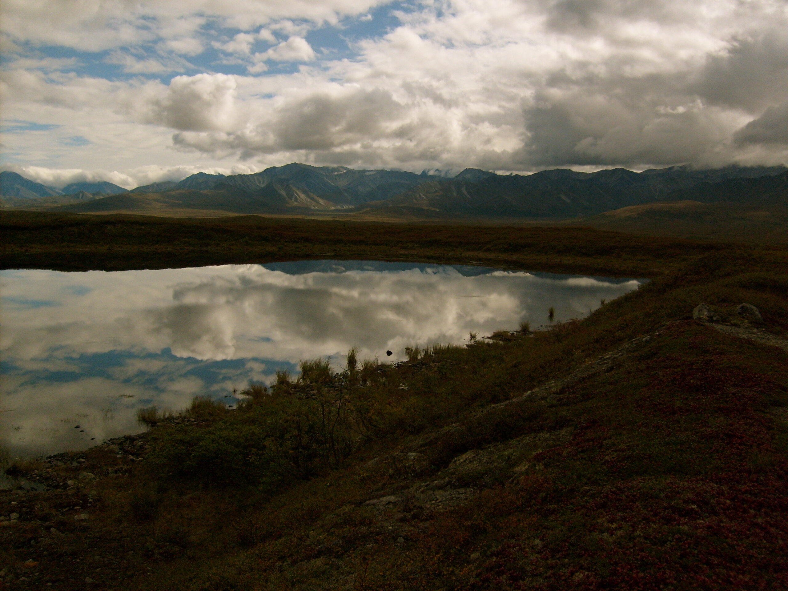
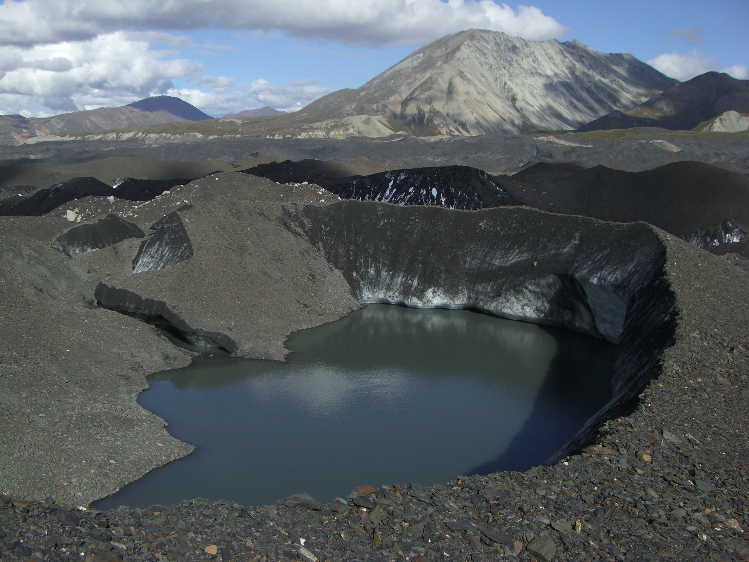
Fantastic mountain peaks and lakes enhance Alaska’s Denali.
The park ranger suggested that we use our willpower to follow his mantra, “Accept wet feet,” and cross the many rivers during our trip wearing our hiking books, which required spending the entire trip in wet boots. The alternative, of course, required carrying a second set of shoes in heavy backpacks for the entire trip. In deep, fast-moving, silt- and rock-filled rivers, sandals are not an option because there is too high a risk of breaking a toe or foot — and when you’re a three-day walk from medical attention, you don’t want to break anything. We decided that the ranger’s mantra sounded too, uh, wet, for us, and we decided to carry light sneakers in our packs. After camping about a mile north of the river the night before, we woke up early as instructed (we thought we were “really committed”), packed everything from our backpacks including our hiking boots into waterproof bags, and made our way to the river’s edge.
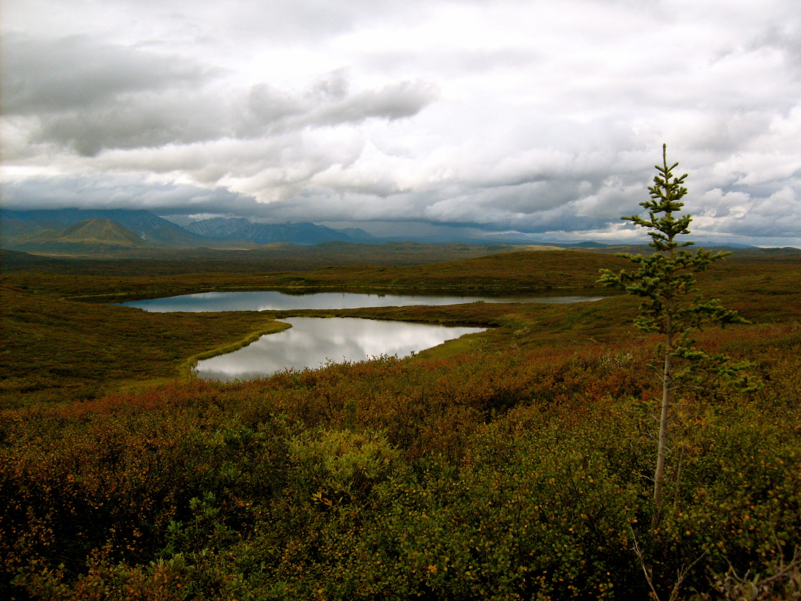
Mountain lakes can be seen throughout Denali National Park.
Counter to intuition, the best place to cross a braided river like the McKinley is at its widest point, when the river’s water spreads across many channels (or braids). The individual channels are shallower and slower moving than at river’s narrowest point, where all of the braids are combined into a dangerous, freezing, fast-moving current. Using our topographical map and compass to guide us, we walked to the river’s widest point and began crossing.
Each braid was harder than the previous; at first the water only reached our shins, but in later braids it reached our knees, our waists, and eventually, about halfway through our crossing, it reached our chests. Silt made the water opaque, so we painstakingly searched for the best place to cross each braid by throwing rocks into the water to test depth as we slogged through a labyrinth of rock bars between braids. We used all of the crossing techniques we knew (facing upstream, walking sideways, using walking sticks, and stabilizing against each other), but the crossing became progressively more difficult as the river became deeper and we became colder and wetter (water at 36 degrees Fahrenheit without a dry suit is unbearable for any length of time).
Mountain lakes can be seen throughout Denali National Park.
Eventually, we became trapped on a small rock bar with very little space to move up or down stream. We knew (by throwing rocks) that the next braid was at least as deep as the last, but there wasn’t much we could do to change the situation without crossing braids in reverse and moving backward, so we decided to try crossing the next channel from our current position. As we stepped in, the water reached above our waist, but we knew it would be passable. Then, we took a second step and discovered that the river-bottom had a sheer drop-off.
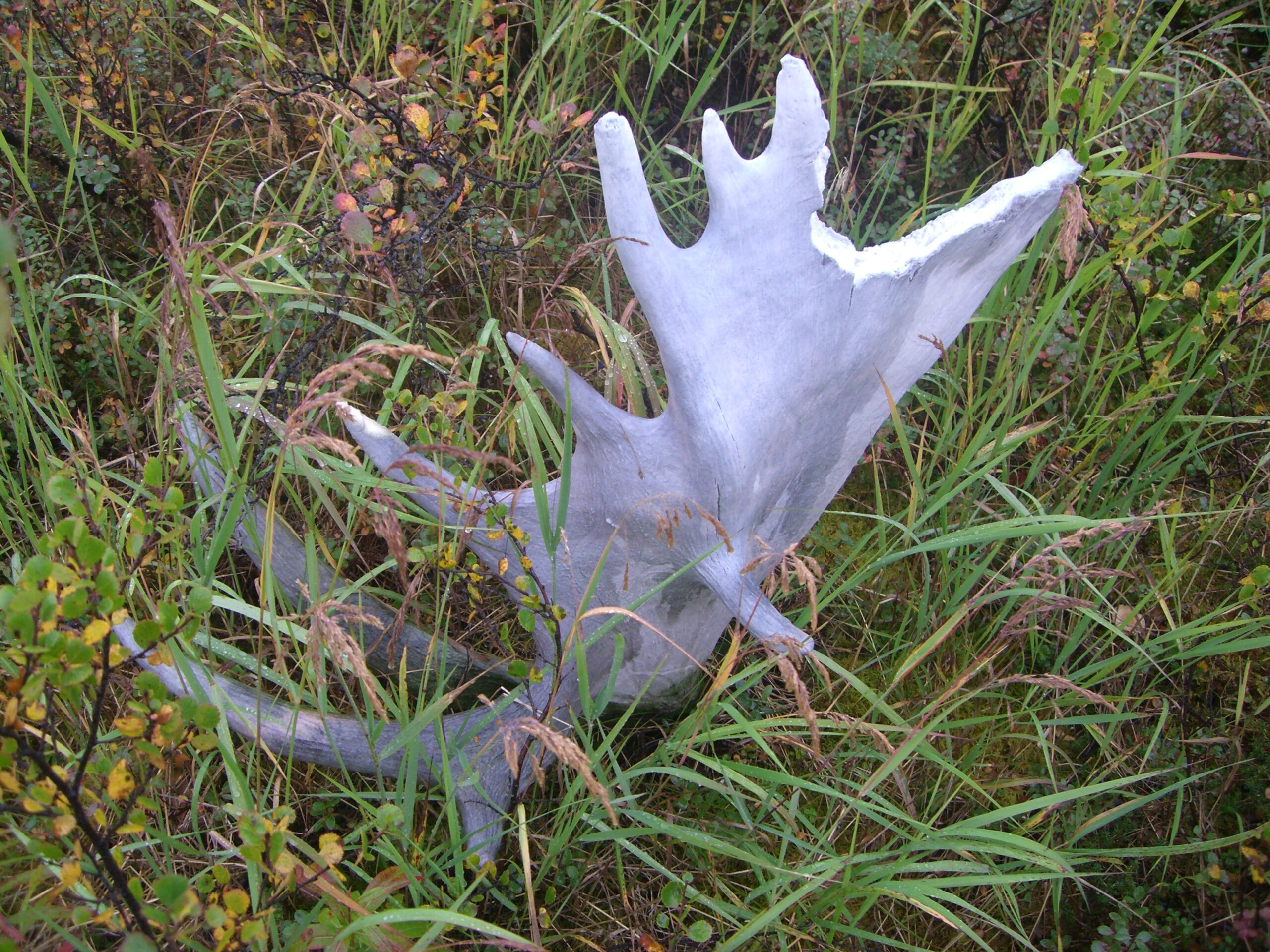
Shed caribou antlers sit on the ground in Denali National Park.
In an instant, water was above our heads and we were floating downstream at 20 miles per hour in 36-degree water with 45-pound backpacks strapped to our backs.
As I looked into my brother’s eyes, I could see that he thought we were going to die, and I telepathically agreed. I thought to myself, “This is how those stupid people you read about in newspapers die in the wilderness.” Absolutely terrified, we desperately began swimming toward the far river bank as we bulleted downstream. The river channel curved slightly, and in a moment of pure-adrenaline combined with unrestrained terror, my brother frantically clawed his way onto the rock bar on the far bank. I slammed my legs and feet down into river bottom to try to slow myself and get to the shore, but the rapid current was pulling me much too fast and my legs simply buckled under me. Suddenly, my brother held out his walking stick. I grabbed it, and with all of my strength, pulled myself to the shore and desperately lifted myself out of the water.
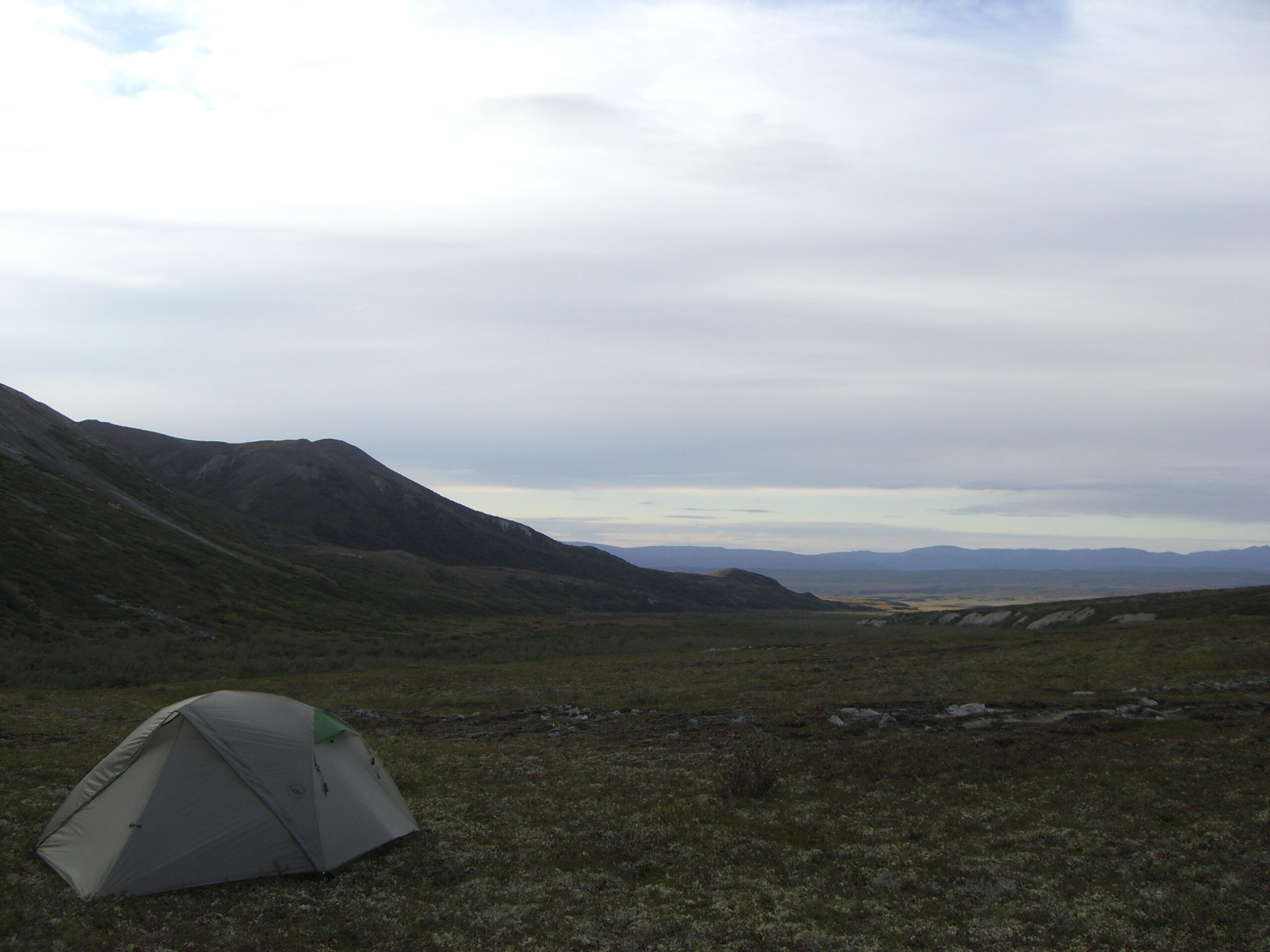
Our tent sits in a mountain pass under an overcast sky in Denali, Alaska.
Emotionally, it wasn’t over. For over 20 minutes, my brother paced up and down the 20-foot rock bar trying to warm his body and screaming about the pain in his hands (did I mention the temperature of the water?). I stood almost motionless, in shock, with my body incessantly and involuntarily burping water and air out of my lungs.
The worst thing about our making it halfway across the river was that there was no way to turn back. Under other circumstances, we might have turned around — but turning around meant crossing not only the same deep, treacherous channel all over again, but also crossing every channel we had already crossed. Hoping that the trip couldn’t possibly get any more difficult, we continued.
Thankfully, the worst was behind us, and after five hours of grueling river crossing, we arrived safely at the other side. We pitched our tent, put our wet clothes out to dry, and finished sleeping from where we had left off at three in the morning.
Little did we know that the harrowing experience of crossing the McKinley wouldn’t even be the most difficult part of our trek.
Bear ye! Bear ye!
Avoiding bears in the Alaskan wilderness requires impenetrable canisters and creative chanting.
AUGUST 29, 2007 — As my brother Brian and I trudged forward through the thick, head-high underbrush on Denali National Park and Preserve‘s six million-acre sub-arctic tundra following a harrowing McKinley River crossing, our continuous shouts of “Bear ye! Bear ye!” could be heard for miles. After watching the park’s bear safety video before venturing into the wilderness, we obediently invented this chant, paring it down from a longer, original rhyme we created: “If a bear ye see, stay ye be!” (Actually, our original chant was much longer but became too cumbersome to help us remember anything: “If a bear ye see, stay ye be. If a moose be there, run with care; and if while running with care, if a black bear be there, throw sticks and stones to break its bones — and the same goes for wolves.”) None of the chants made much sense, but regardless, we knew that the best way to avoid surprising a bear — which is all too easy when you can’t see five feet in front of you due to the underbrush — was to announce our presence by yelling, “Bear ye! Bear ye!” The park prohibits venturing within a half mile of a bear, but accidental encounters do happen.
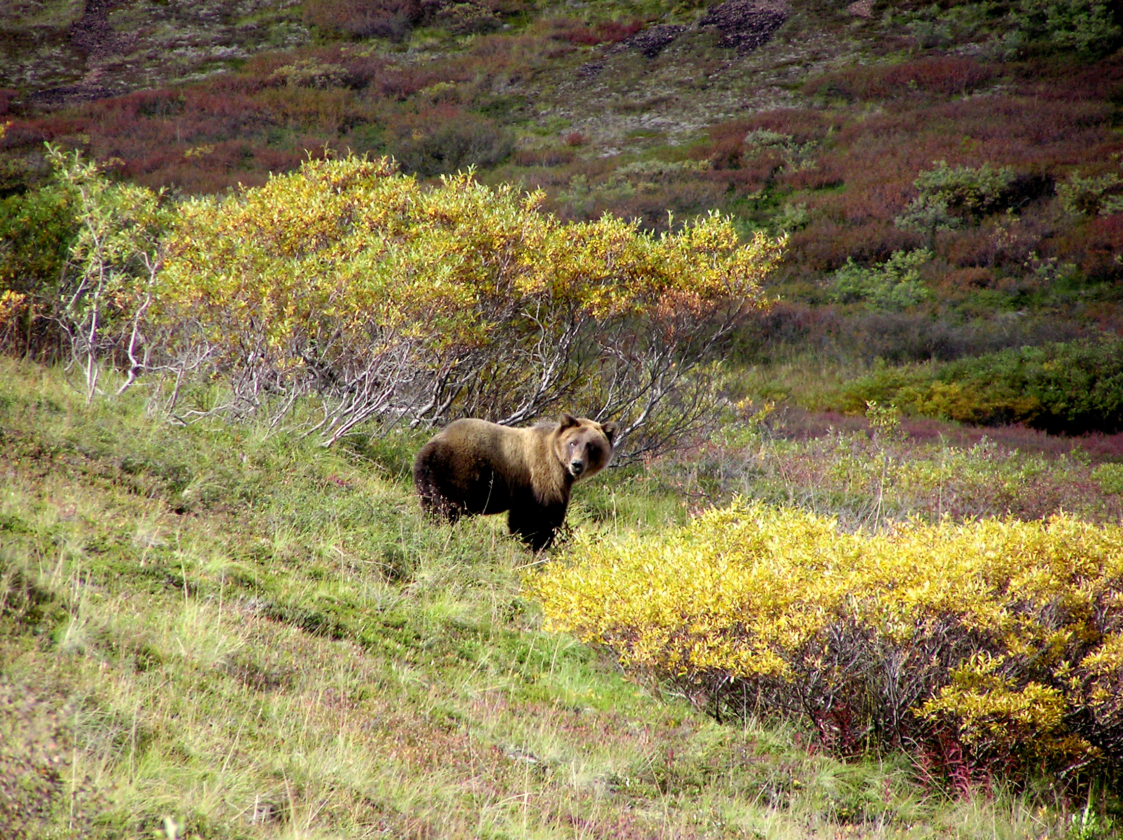
A Denali grizzly bear stands near the Park road. (photo by Brian Leukart)
Bears don’t like to be surprised, but they love eating backpackers’ camping food. Thus, the park issues every backcountry hiker an impenetrable bear-proof canister (though my brother and I worried that if a bear ever got hold of a screwdriver, the bears would quickly rule the park). We were required to carry anything with a scent (food, deodorant, toothpaste) in the containers and follow the rule of the Golden Triangle: your tent, cooking area, and bear canister storage area must all be at least 100 feet from each other. These canisters serve two purposes: first, they prevent hikers from losing their food supply to a bear, which can be a disaster if you are a three-day walk from civilization; and second, they condition bears over time to learn that they can’t get food from hikers, and as a result, bears learn not to bother them.
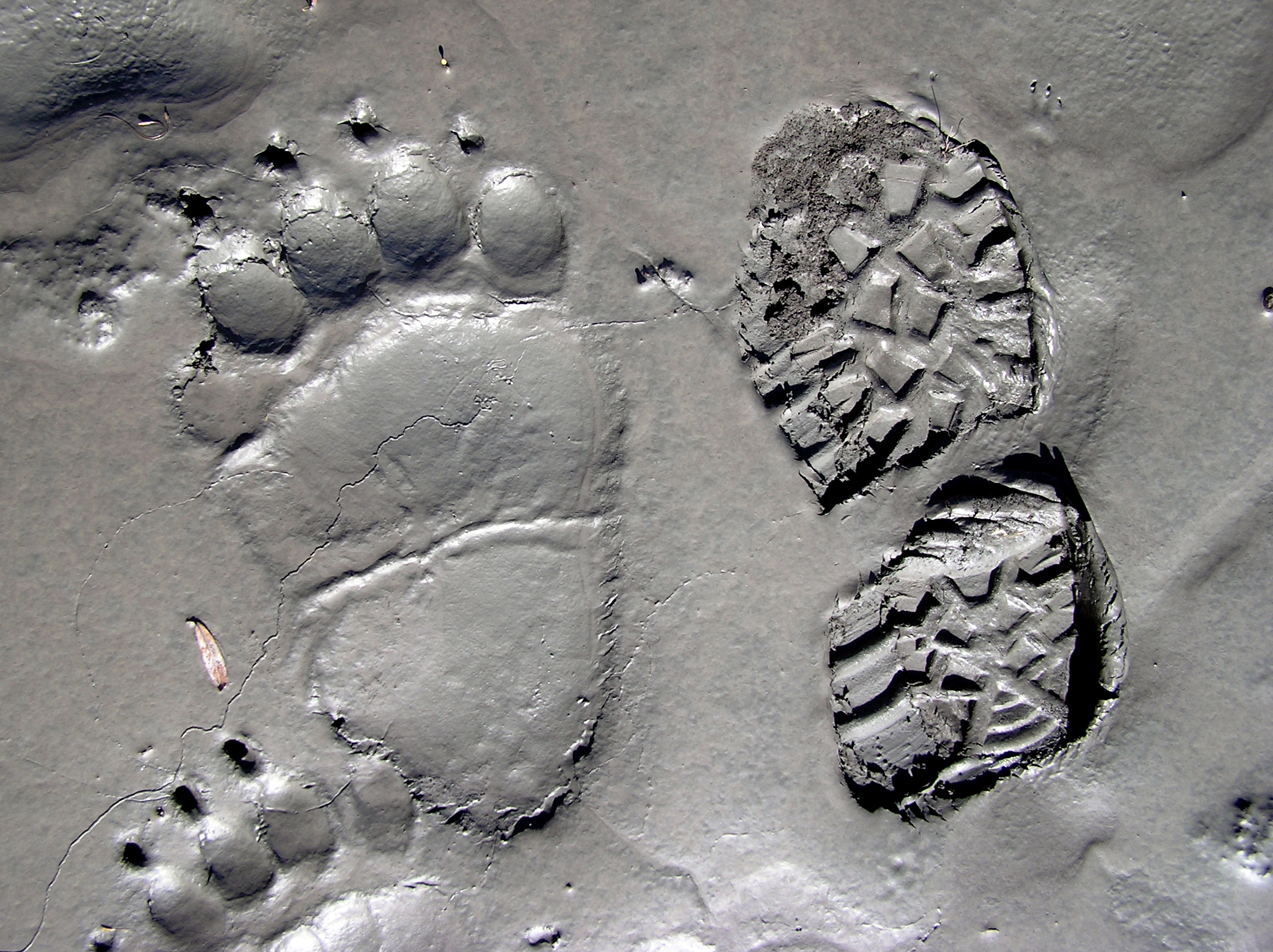
A grizzly bear’s foot imprint sits next to Brian’s hiking boot imprint in muddy clay near a Denali riverbed.
During our first night on the Alaskan tundra, while keeping a constant eye out for bears, we pitched our tent on an arctic forest floor (called “taiga”), made up of spongy moss and grassy vegetation atop springy tree root systems. We quickly named this terrain “mystery mattress” and delighted in the comfort the surface provided us during the night. But we quickly learned that while mattresses make for wonderful sleeping, walking on them is a nightmare. In the wet, lowlands of Denali, even without much underbrush, “mystery mattress” hiking can be four to six times slower than hiking on a trail. After an especially wet and squishy day in Denali’s lowlands, my brother complained, “I feel like I just worked out on a Stairmaster for six hours straight.” I have no interest in spending six hours on my gym’s Stairmaster to test this theory, but I’m confident it’s accurate. As we became better acquainted with Denali’s terrain, we soon realized that hiking ten miles per day was outside our realm of possibility. We also laughed nervously that we were instructed never to run from a bear — with this kind of terrain, running from anything dangerous was impossible no matter the predator. Frequent rain showers made the situation even worse (the skies are so often overcast that Mount MicKinley is only visible every third day), and we promptly learned that the only thing more difficult than hiking on miles of spongy mattress is hiking on miles of soaking wet, spongy mattress.
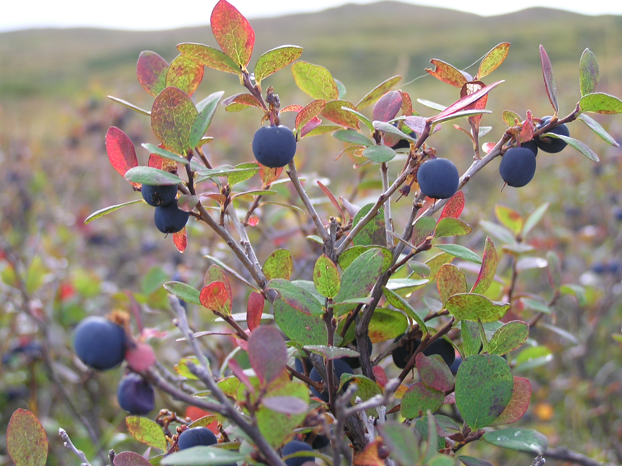
Blueberries blanket the wilderness in Denali National Park.
Because the glacially-fed rivers in Denali don’t hold many fish, the park’s grizzly bears’ diets are 85 percent vegetarian. Fortunately for them, the frequent rain makes possible one of the area’s most mind-boggling features: thousands and thousands of acres of wild blueberry bushes blanket almost every square inch of Denali’s lowlands. At first, we felt bad stepping on any berries until we discovered that the park’s blueberry supply was inexhaustible. At the beginning of our trip, while looking out over hundreds of miles of tundra covered with blueberries, my brother ironically exclaimed, “I’ll never get sick of blueberries!” knowing that after eight days, we surely would.
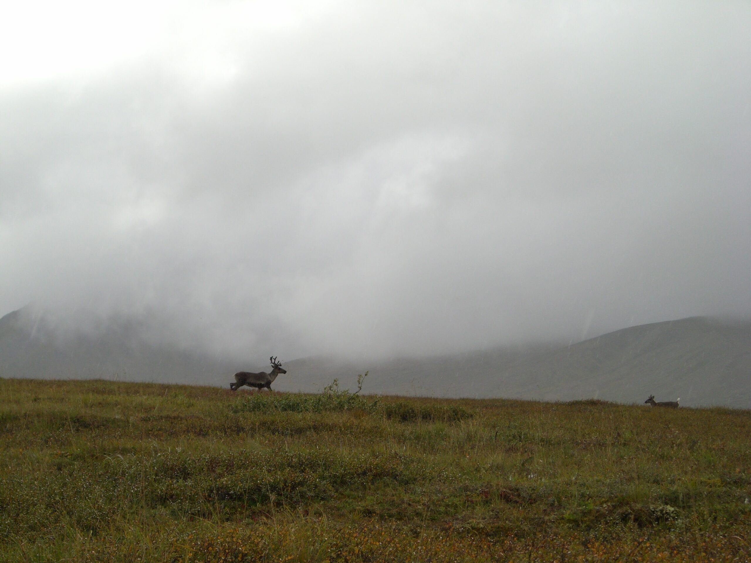
Caribou run across the horizon in Denali National Park.
As we slogged through Denali’s wet and mushy tundra, we often spotted fresh, staggeringly large bear tracks in the mud. We simply hoped that the track-makers didn’t decide to change from the stalkees to the stalkers. Probably due to our frequent yelling of, “Bear ye! Bear ye,” we thankfully never came in close contact with a grizzly bear during our time alone in the wilderness.
But one night, we stood in the middle of a seemingly endless Denali tundra with literally millions of wild blueberries blanketing our world in every direction, as far as we could see. Exhausted, we collapsed on the ground and began munching on the blueberries in our vicinity, which seemed tastier than any we had ever eaten. Apparently, we weren’t the only ones who thought so.
Obscuring the horizon, less than a eighth of a mile away, we spotted a majestic family of caribou. They, too, were munching on the wild blueberries as the sun set behind Denali’s striking mountain ranges. We watched them with curiosity, and with just as much curiosity, they watched us eat. Eventually, with our eyes fixated on the animals and our mouths stuffed full of blueberries, the sun disappeared below the horizon, and the caribou disappeared into the darkness.
Somehow, we never got sick of those blueberries.
Conquering Mordor
Crossing a glacier in the Alaskan wilderness is harder than it looks.
AUGUST 31, 2007 — Originally, my brother Brian and I planned to spend only five days in Denali National Park’s stunning, untamed wilderness, hiking from Wonder Lake to the base of Mount McKinley, and then retracing our steps for a grand total of 40 miles. Despite our lack of “extensive river crossing experience,” no one could have accused us of being ill-prepared for our journey. We packed four extra meals in case of an emergency and lugged survival equipment including wind- and water-proof matches and fire-starters, detailed topographical maps with heavy-duty compasses, two bear-proof canisters, an emergency heat blanket, enough plastic bags to waterproof every item we carried, and a first-aid kit and backcountry medical book that explained how to create improvised leg splits and avoid lightning strikes. Oh — and we even brought video iPods to watch episodes of Battlestar Galactica and How I Met Your Mother and four board games to deal with any boredom crises.
Hank slowly makes his way across Muldrow Glacier. (photo by Brian Leukart)
Yet, trips like this never go exactly as planned. Even before stepping one foot into the wilderness, we had devised a backup plan to avoid crossing the McKinley River a second time. Our “backup plan” required us to cross two-mile wide Muldrow Glacier and hike an extra 15 miles to avoid the river. Of course, after our harrowing river-crossing experience, our “backup plan” quickly became our primary plan.
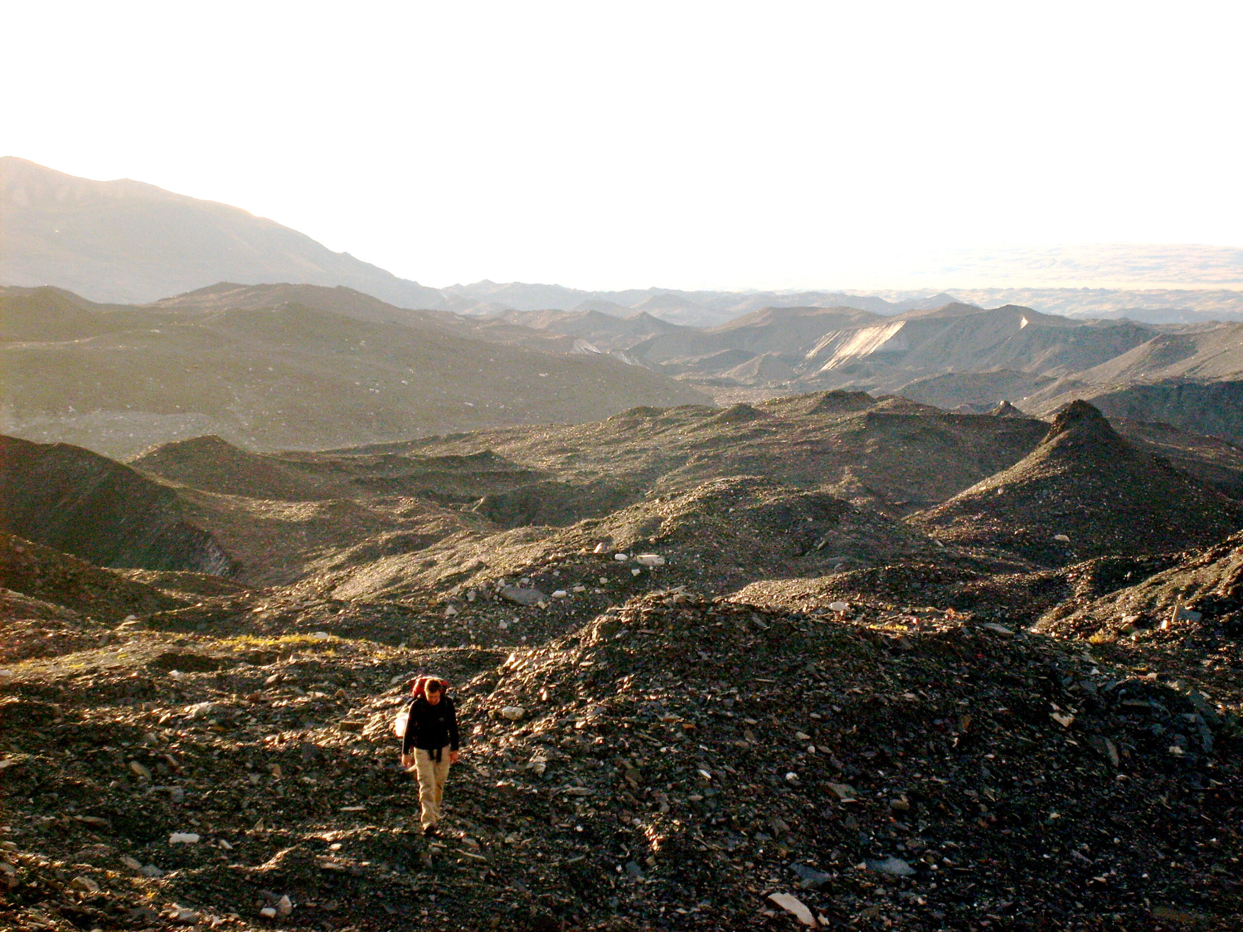
On our third day, as we neared the base of Mount McKinley, we lost track of the old mountaineering trail we were following. Though we weren’t lost (my brother became an expert at taking bearings with a compass to triangulate our location on our maps), this did mean that we were forced to spend a full day hiking through dense thickets, at least quadrupling the time we required to hike a mile.
We were averaging fewer than seven miles per day, and it became clear that not only would we miss our return flights out of Anchorage, but even with our backup food supply, we would run out of food well before we escaped the park. In short, we weren’t going to make it.
During our fourth night, after a day enveloped in rain, our morale reached a low-point. Around this time, the constant rain showers prompted us to invent a game we lovingly called, “Wet or Cold?” (The game’s full title, “Just Wet, Just Cold, Both Wet and Cold, or Neither Wet nor Cold?” was too cumbersome.) This simple game required us to grab any piece of our clothing and guess in which of the four aforementioned categories the item fell. Honestly, this game is much harder than it sounds — we were often hard-pressed to decide whether a pair of socks was soaking wet or simply freezing cold.
Brian looks across Muldrow Glacier from the top of one of its many peaks.
During rounds of “Wet or Cold” that night, we realized that we had to come up with a plan escape the park alive. We decided to shave about 8 miles off our “backup” itinerary’s total distance by not hiking completely into the pass at the base of Mount McKinley, we planned a couple difficult shortcuts through mountain passes, and we committed to hiking at least 8 miles per day for the remainder of the trip.
We began our fifth day reenergized and began the long march required to avoid crossing the McKinley River a second time. We endured some difficult hiking, but on the morning of the seventh day, we awoke to a totally clear sky and a beautiful sun shining down upon us. Fewer than 8 miles remained in our journey, and the gorgeous weather seemed to be a sign from the heavens that we were close to success. Bathed in sunlight, we bounded across meadows, rocky river beds, and miles of marshes and bogs until we reached a towering ridge.
Melted ice sites in a rock bed on Muldrow Glacier.
We ascended the ridge quickly, and in the blinding sunlight, we looked out onto an epic slab of glacial ice over two miles wide and 20 miles long, shaped by hundreds of peaks rising over 300 feet into the air and almost completely coated in perilous, softball-sized rocks. The only interruptions to the glacial terrain were sheer ice walls making a “direct” route across the glacier (over many towering peaks) impossible.
Looking out onto the brutal landscape, my brother muttered meekly, “We have to cross Mordor.” For the uninitiated, Mordor is the final, petrifying stretch of the epic journey to Mount Doom traveled by the characters in J.R.R. Tolkien’s The Lord of the Rings trilogy. On a number of levels, the comparison was apt, and I admit now that my personal understanding of classic epic journey stories like The Odyssey, The Princess Bride, and The Lord of the Rings has deepened considerably.
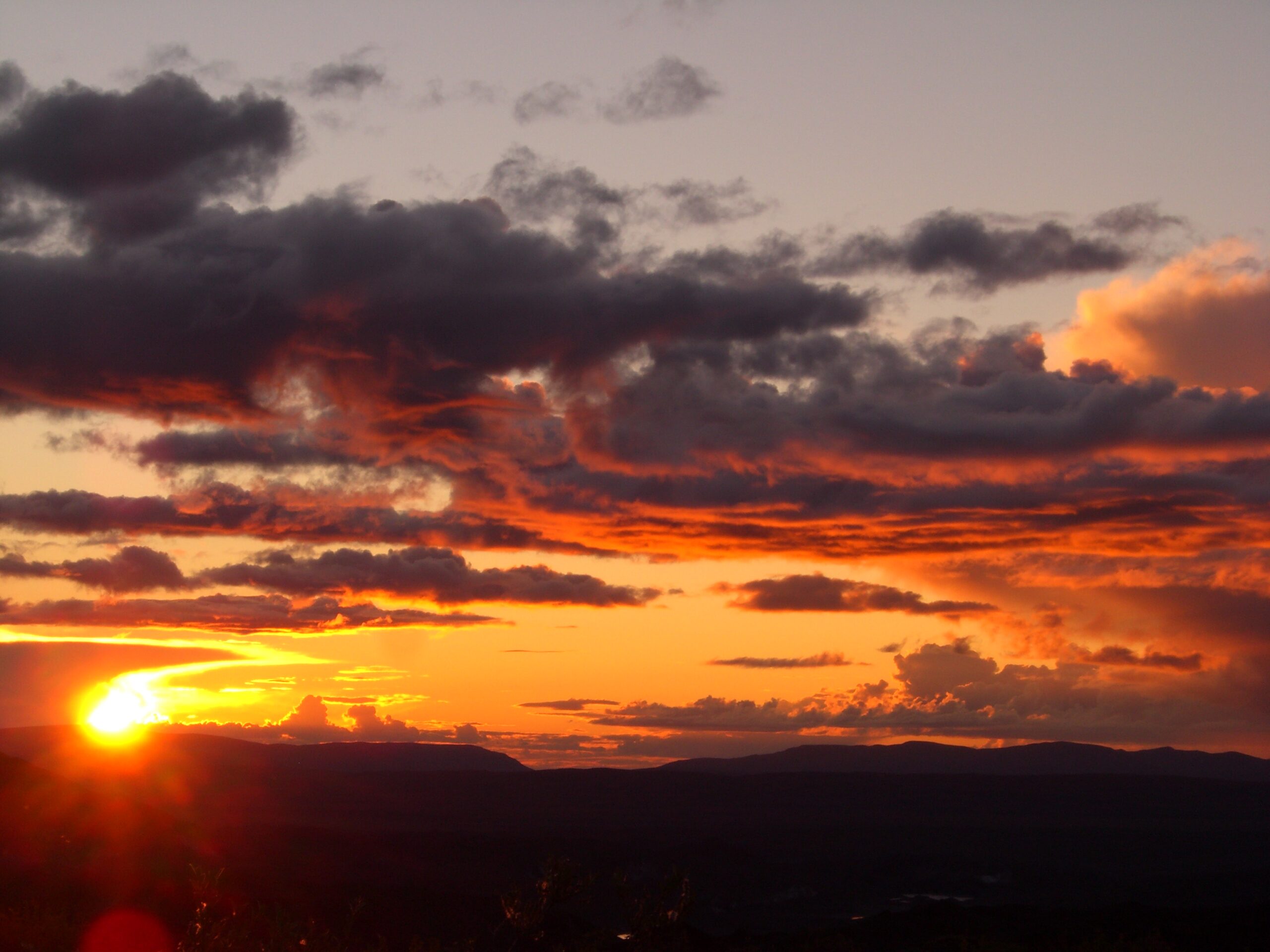
The sun sets over Denali National Park.
And so, with terrified looks on our faces, we set out to cross Mordor. Trying to cross the glacier was like trying to navigate an enormous maze of sheer ice walls. For hours, we slogged across thousands of rocks and climbed over peaks searching for a viable path across. The ice walls often required us to take circuitous routes to our destination and scale peaks that looked impossible to climb until we were forced to try. Once, we followed a comparatively safe path for almost thirty minutes when suddenly, we were completely surrounded by unscalable walls of sheer ice. We were rats trapped in a maze, and we weren’t sure we would ever escape. Incredibly enough, we began wondering whether crossing the McKinley River again would have been easier than navigating the glacier.
Fields of flowers pave the way back to the Denali Park road.
We only had one choice, so we spent a half hour backtracking until we found another path to try. Of course, we could never be sure we were following the right path in the glacial maze — peaks constantly limited our visibility making it almost impossible to plan ahead.
Eventually, after seven hours of some of the hardest hiking I’ve ever done, we completed the two miles across the glacier (though our actual distance traveled was probably three times that due to the route we were forced to take). We knew we weren’t going to make it to the road that night. The instant we stepped off the glacier, we pitched our tent, cooked half of our last dinner (the other half we needed to save for breakfast the following morning), and fell asleep.
In the morning, we finished all of our remaining food (a bowl of soup and some granola bars) and set out to hike the final four miles to the park’s only road. As we began, I joked that the only fitting end to our trip would have been a montage of every obstacle (our “twelve trials”) we had faced during the trip. Sure enough, during those last four miles, we pushed through head-high underbrush, trudged across spongy “mystery mattress,” passed over hundreds of fresh bear tracks, and even crossed another braided river. Finally, we climbed 500 feet to the top of a ridge to reach the dirt road that returned us to civilization.
On the top of the ridge, a group of tourists spent over an hour watching us tackle that final stretch. When we reached them, they greeted us in awe and congratulated us with smiles. They had just finished a picnic, and gave us their leftovers: a feast of apples, Cliff Bars, dried mangos, trail mix, and beef jerky — just in time for lunch.
It wasn’t easy, but we did it. We vanquished the evil Cyclops Polyphemus. We defeated Count Rugen. And we conquered Mordor.
Wow, what an excellent adventure.
Great adventure, and very well written. I also enjoyed your west coast trail accord.
greets from the netherlands!
What time of year (what dates) did you do this hike?
I am extremely impressed with your fortitude, and very glad that you made it across the river alive.
What an adventure!! Thank you for writing about it so well. It made for truly gripping reading.
Your photos are beautiful, too.
I love your article especially the bout with MdKinley River. I went through that experience 41 years ago when descending from summit of McKinley. I had those exact thoughts that you describe in your mental conversation with your brother. Good writing.