OCTOBER 1, 2009 — “Meet Flat Stanley,” my sister Jen says to me as I’m about to leave her house. She hands me a mock child, made from white poster board and colored with crayons by my nephew, Luke.
“Take him with you wherever you go and take pictures,” Jen demands. “Then write a story about what he did. It’ll be easy; you’re the writer and traveler.”
Flat Stanley is the title character in Jeff Brown’s 1964 children’s book, which tells the story of a child who is flattened when a falling bulletin board crushes him while he’s sleeping. As Jen tells it to me, the story strikes me as surprisingly scary and morbid, especially in a book meant for children, but then I remember enjoying as a kid the terrifying stories of genius children’s writer Roald Dahl. I suppose that the scariest children’s stories are also usually the best.
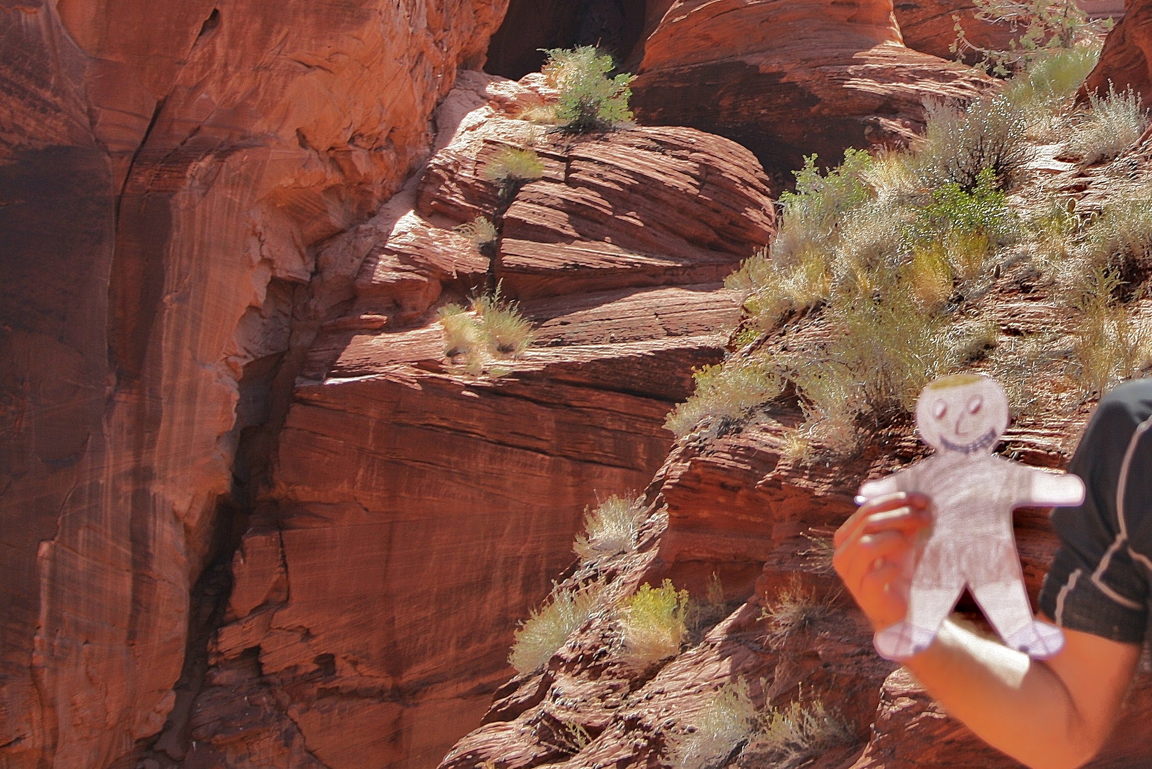
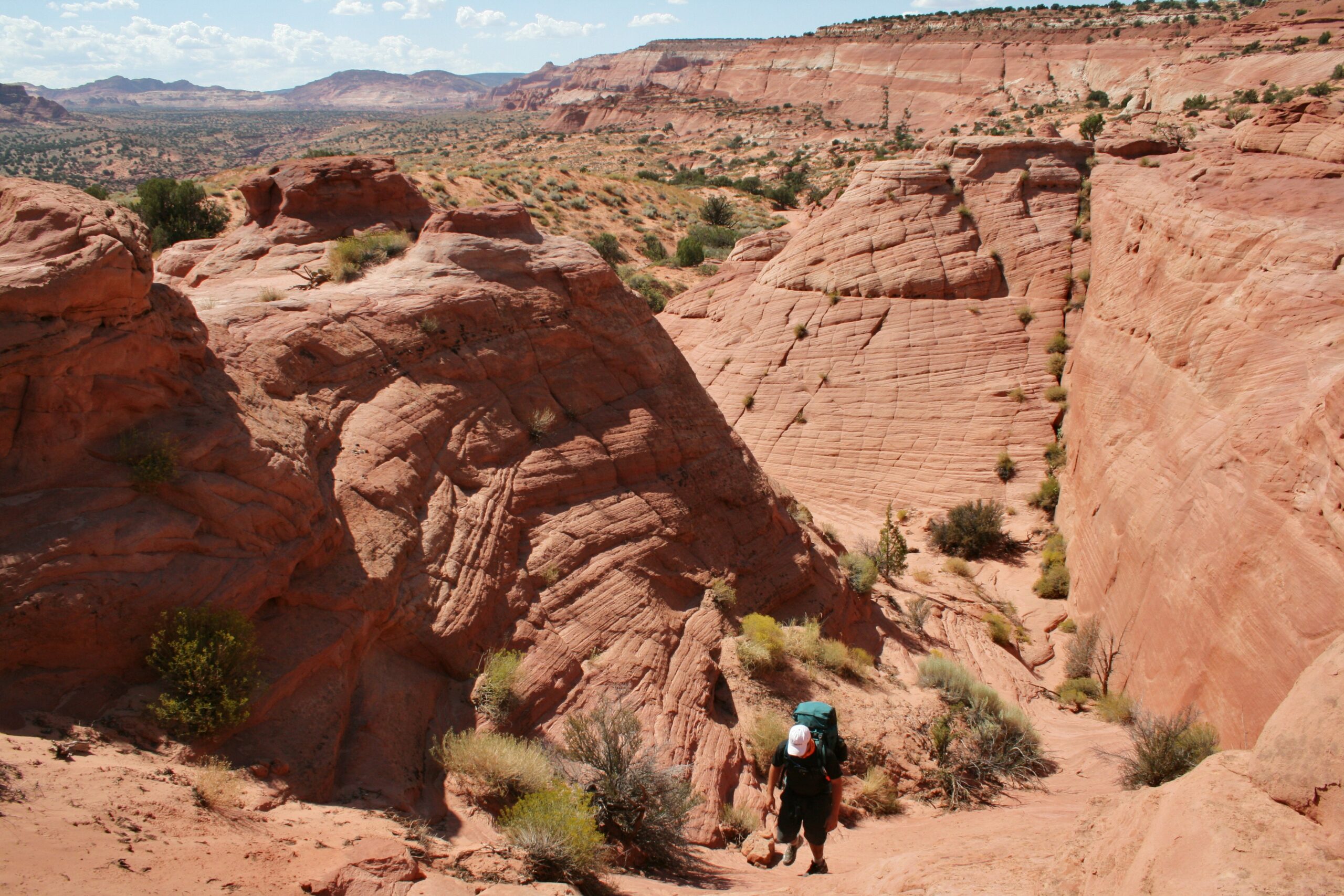
Flat Stanley marvels at the scenery in Buckskin Gulch.
In Brown’s book, the newly-flat Stanley quickly learns how to sneak under doors into locked rooms and visit faraway places through the mail. My nephew’s school project requires him to send his Flat Stanley, escorted by friends and relatives, to adventurous and exotic places. Of course, Luke wants his Stanley to travel to places even more adventurous and more exotic than those visited by his classmates’ Stanleys.
Jen thinks naively that giving me Luke’s Flat Stanley is a good idea, because I’m about to drive with my friends Wendy, Rich, Suzanne, and Wini to the remote and rugged Paria Canyon-Vermillion Cliffs Wilderness on the Utah-Arizona border to hike the length of Buckskin Gulch, the world’s longest slot canyon. I suppose that Utah qualifies as an adventurous and exotic place for this Flat Stanley, especially since he hasn’t left Orange County, ever.
I even concede that Flat Stanley won’t require us to carry any extra supplies considering that he doesn’t eat much and, since he’s made of paper, water is his mortal enemy. But what my sister doesn’t realize is that, unluckily for Stanley, flash floods pose a significant danger to hikers attempting Buckskin Gulch. Backpacker Magazine even ranked Buckskin Gulch as one of America’s ten most dangerous hikes due to floods. Fortunately, for the most part, the risk of a flash flood is manageable. My friend Wendy and I have obsessively checked the weather report over the past week, and meteorologists predict no rain during our trip. In the case of an unpredicted rainstorm, we have read about the existence of a single, treacherous escape route, halfway through the canyon, called Middle Route. Apparently, it’s notoriously difficult to find, partly because it’s camouflaged by the orange sandstone, and partly because GPS devices don’t function in the deep canyon. Most hiking blogs we’ve read suggest that very few hikers have ever found the route, but I find one blog that provides the exit’s geographic coordinates. Of course, I’m not sure how this will help us, assuming that my GPS device won’t work in the canyon. Nevertheless, I am relieved to know that we have Middle Route in case we end up in dire straits. Though it’s not clear that Flat Stanley would be able to manage the steep climb.
Sticky mud pools are a common hazard in Buckskin Gulch.
Due to the popularity of Buckskin Gulch, we reserved five of the required camping permits two months ago. But I imagine that the Bureau of Land Management won’t object to us taking a sixth hiker, one about the size of a Frisbee and weighing less than one ounce. So, my friends and I agree to try to give Flat Stanley the adventure of his short, crayon-filled life.
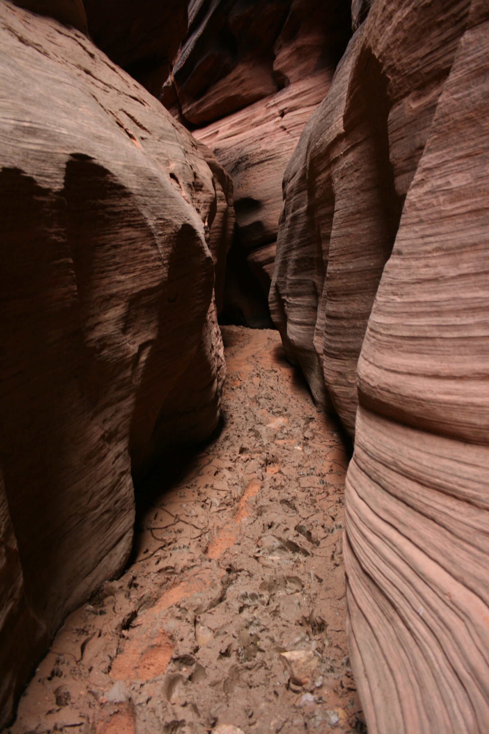
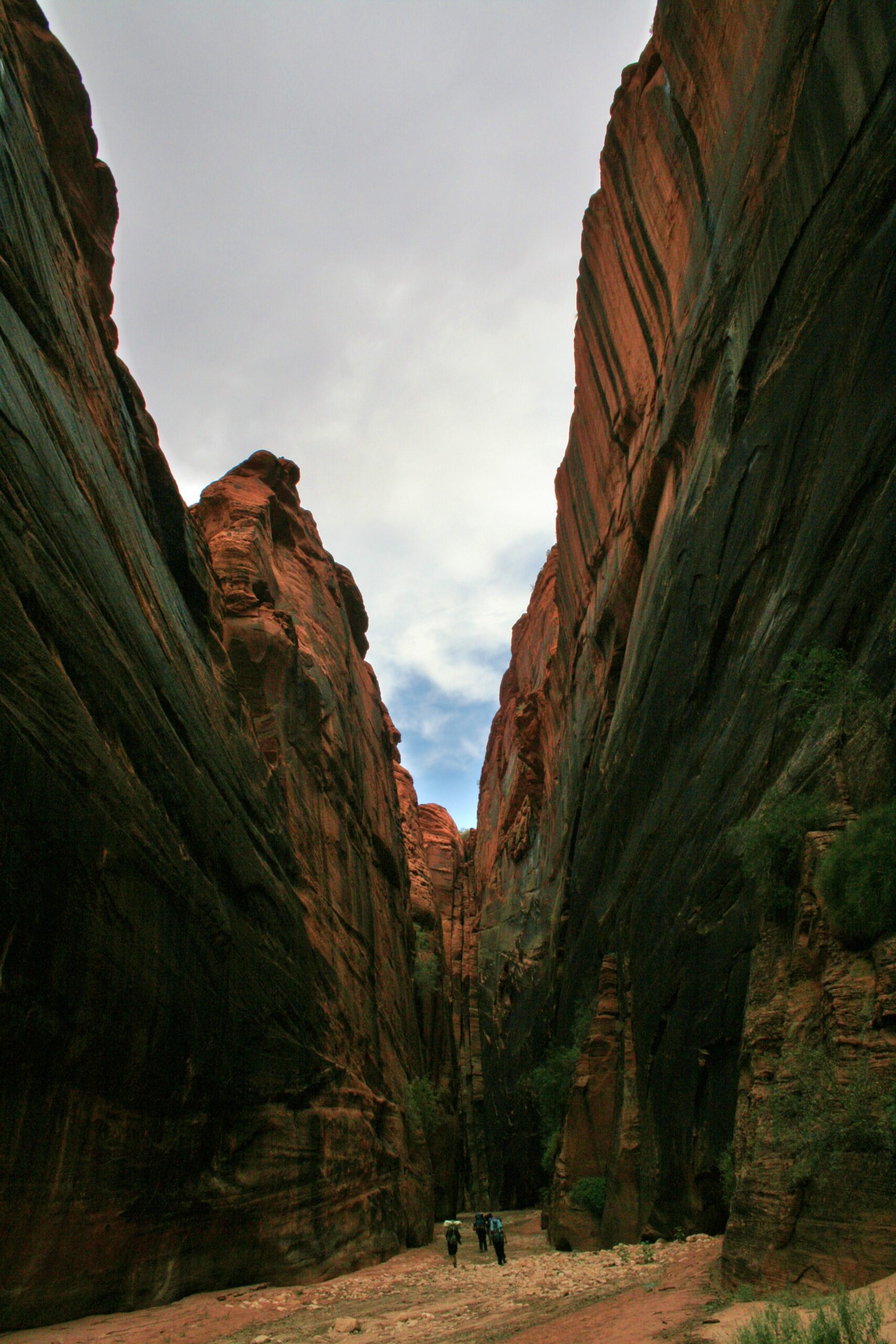
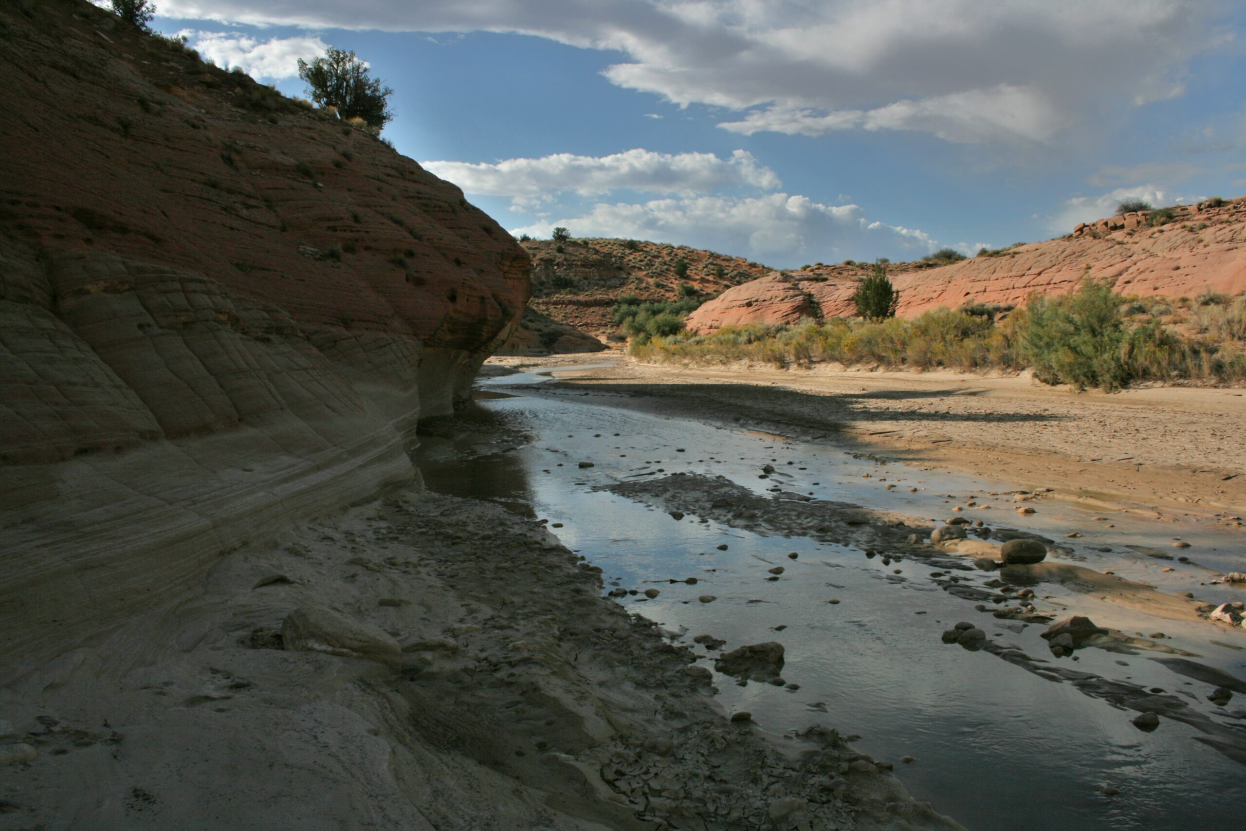
On the morning of our hike, we park two cars, one at each end of our planned route. This takes us longer than expected due to our last-minute decision to hike the entire distance of Buckskin Gulch and the Paria Canyon, from Wire Pass to Lee’s Ferry, a much longer trip than the typical two-day Buckskin Gulch-only hike. So, the group, even Flat Stanley, seems a bit tense when we begin the hike midday, especially Rich and Suzanne, our unfaltering worrywarts. But when we enter the canyon and begin walking between the narrow, red and orange sandstone walls, everyone smiles and laughs as we trudge through the deep, gooey, and smelly water and mud pools. To protect Flat Stanley from certain death, I heroically carry him above the water and mud. It’s clear that everyone is having fun.
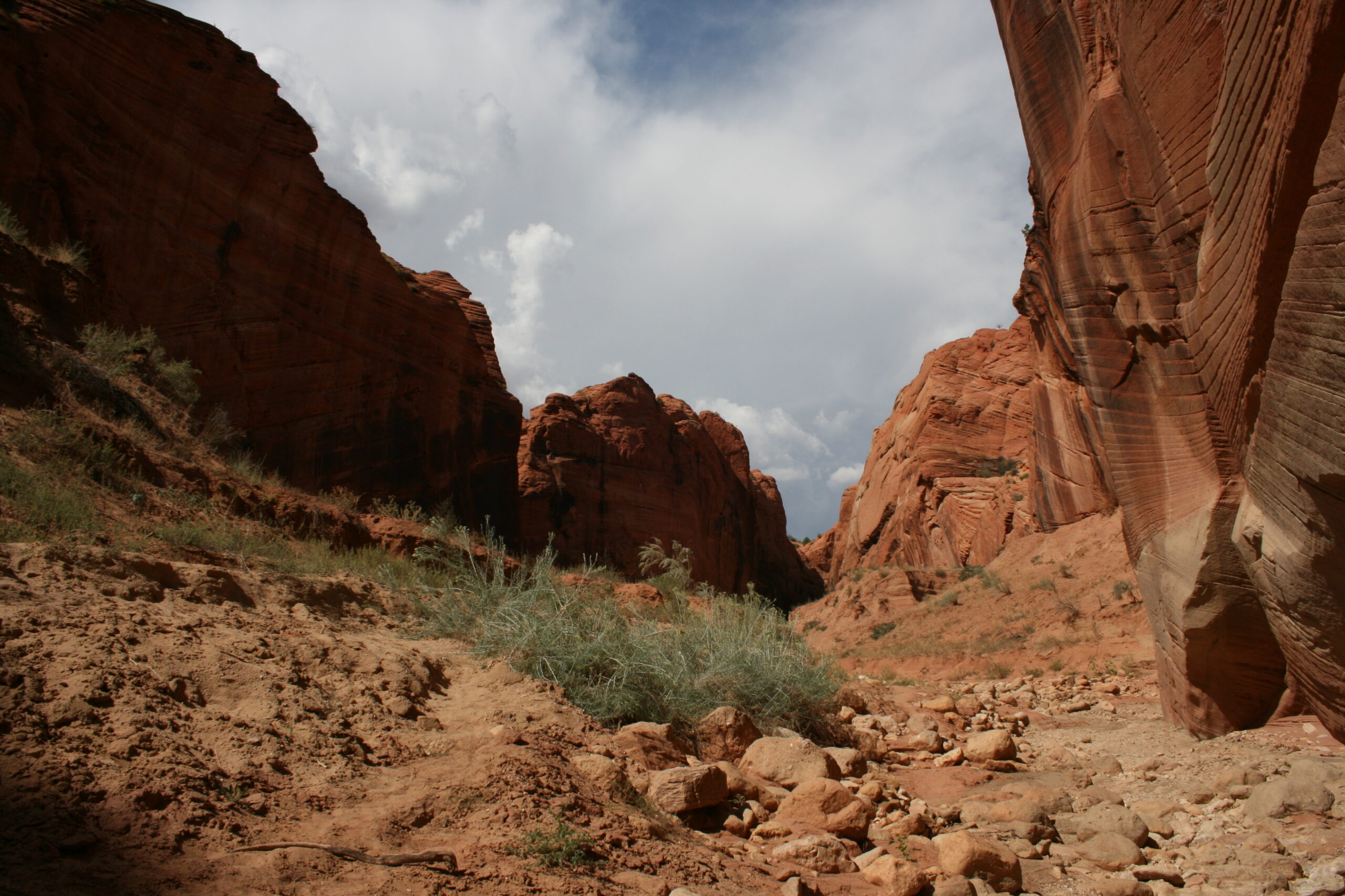
Ominous clouds appear overhead while hiking near Wire Pass.
But soon after we pass a panel of Native American petroglyphs depicting desert bighorn sheep on the canyon wall near the junction of Wire Pass and Buckskin Gulch, I hear the sound of a single thunder clap.
“Did you hear that?!” Rich asks me, nervously.
“Yes,” I say, uncomfortably. “But it sounded like it was very far away. I haven’t felt any raindrops.”
But after another half mile of hiking, between canyon walls reaching nearly 500 feet above us, everyone in the group feels a couple raindrops.
“I think we should turn back now,” says a worried Suzanne. Next to the water-susceptible Flat Stanley, she is the most risk-adverse hiker in our group.
“I am not turning back now,” Wendy says firmly. But our major concern is that there are only two safe places for us to camp: at the confluence of the Paria River and Buckskin Gulch (11.5 miles away) and atop the apparently impossible-to-find Middle Route escape trail (6 miles away). If we choose to continue, we must reach one of these two exits, because camping on the floor of the canyon is a recipe for certain death in the case of a flash flood.
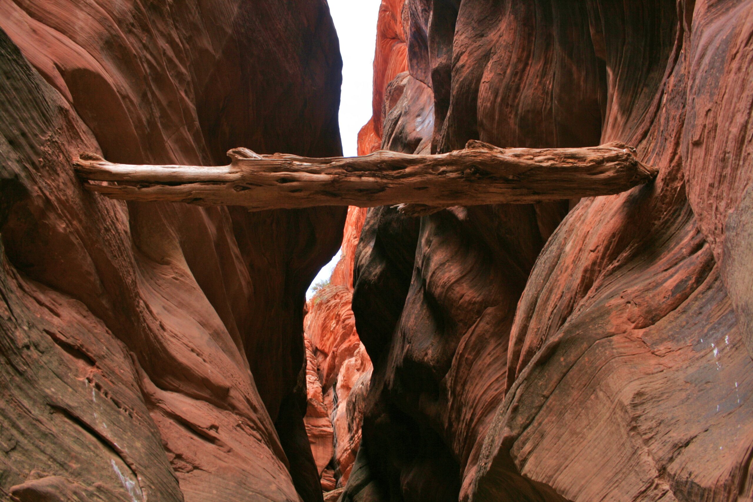
A log sits, wedged between the walls of Buckskin Gulch, from a previous flash flood.
“Look, if it starts actually raining, I agree that we should turn back,” I say. “But I’ve only felt two rain drops, the sky looks mostly clear, and we can always hike out through Middle Route if we have to.”
“But no one has ever found the Middle Route,” Suzanne argues.
“I am not turning back,” Wendy repeats.
Flat Stanley, always mysteriously pensive, stays silent on the matter. Even without his input, the group decides to continue hiking. As we continue, the canyon narrows, the standing pools of water get colder, and the mud gets deeper. But we relax when we see the sky clear. We don’t feel any more raindrops.
We hike slowly, giving us time to enjoy the fantastic, alien scenery fully and take photos. Soon, it becomes obvious that we won’t make it to the first safe campsite before dark. We begin looking obsessively for the enigmatic Middle Route. I notice that though my GPS usually won’t function in the canyon, it intermittently springs to life whenever the walls surrounding us become lower. I watch it as the displayed coordinates become closer to matching those of the emergency exit. Flat Stanley appears unconcerned.
Hikers make their way through a particularly wide section of Buckskin Gulch.
After seven miles of hiking, everyone is tired from our heavy packs filled with over eight pounds of water per person (no water sources are available in the canyon). We still don’t think we have seen the Middle Route, but we don’t know exactly what it looks like — everything we’ve read about it only describes a slight widening and lowering of the surrounding canyon walls. We feel like we’re on a mission with Victorian explorer John Cabot, searching for a Northwest Passage that we’re sure exists but consistently eludes us. Wini and I, hiking ahead of the group, see a number of possible emergency exit candidates, but then we inevitably realize that some feature — their steepness, their slipperiness, or their overall precariousness — means that they can’t be the Middle Route. But, finally, we spot a steep route up the walls, across jagged, sand-covered stone, on the canyon’s left side. When I look at the GPS, which, thankfully, happens to be functioning because the canyon walls have temporarily widened, the coordinates are correct.
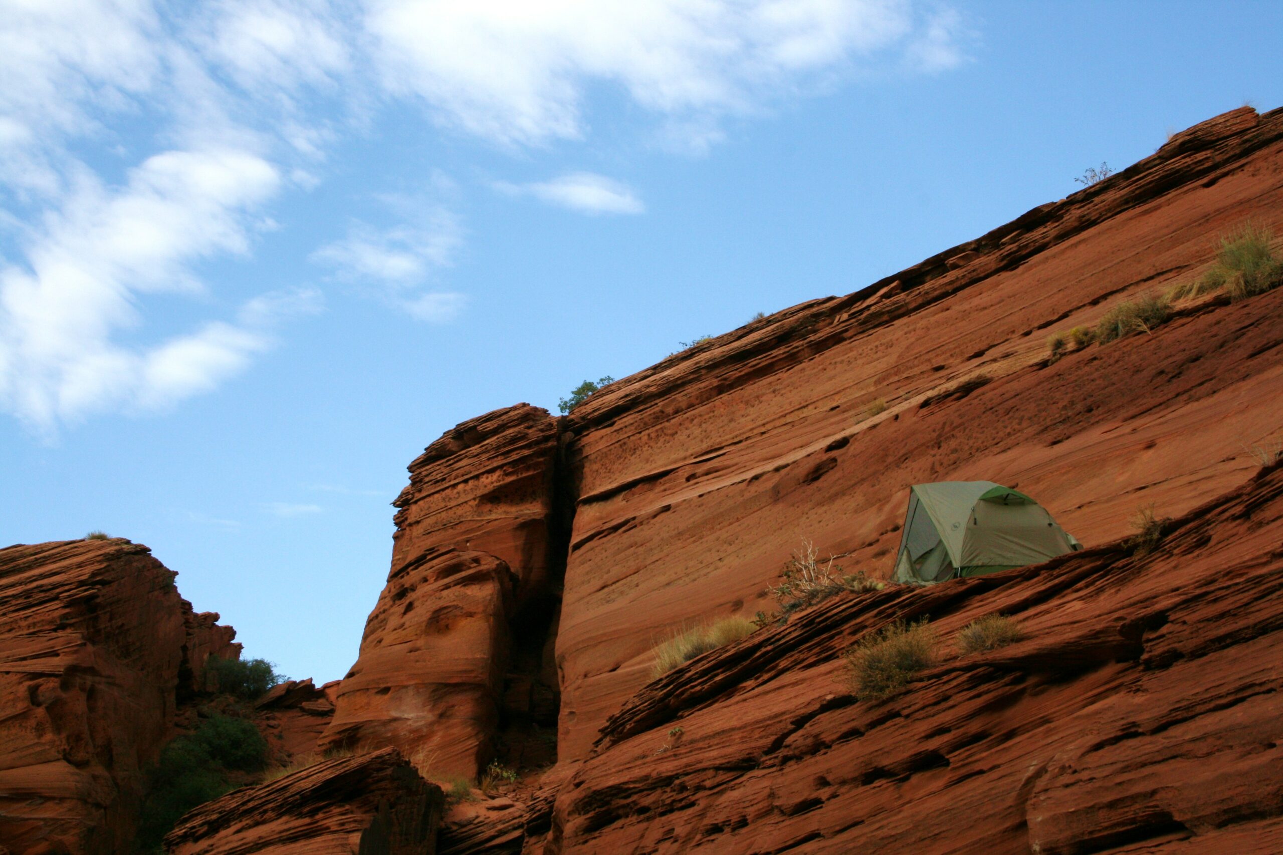
A tent sits high on a ledge near the Middle Route, in a place we named The Penthouse.
“We’ve found the Middle Route!” I yell to the rest of the group as though I’ve just discovered a lucrative trading route to India.
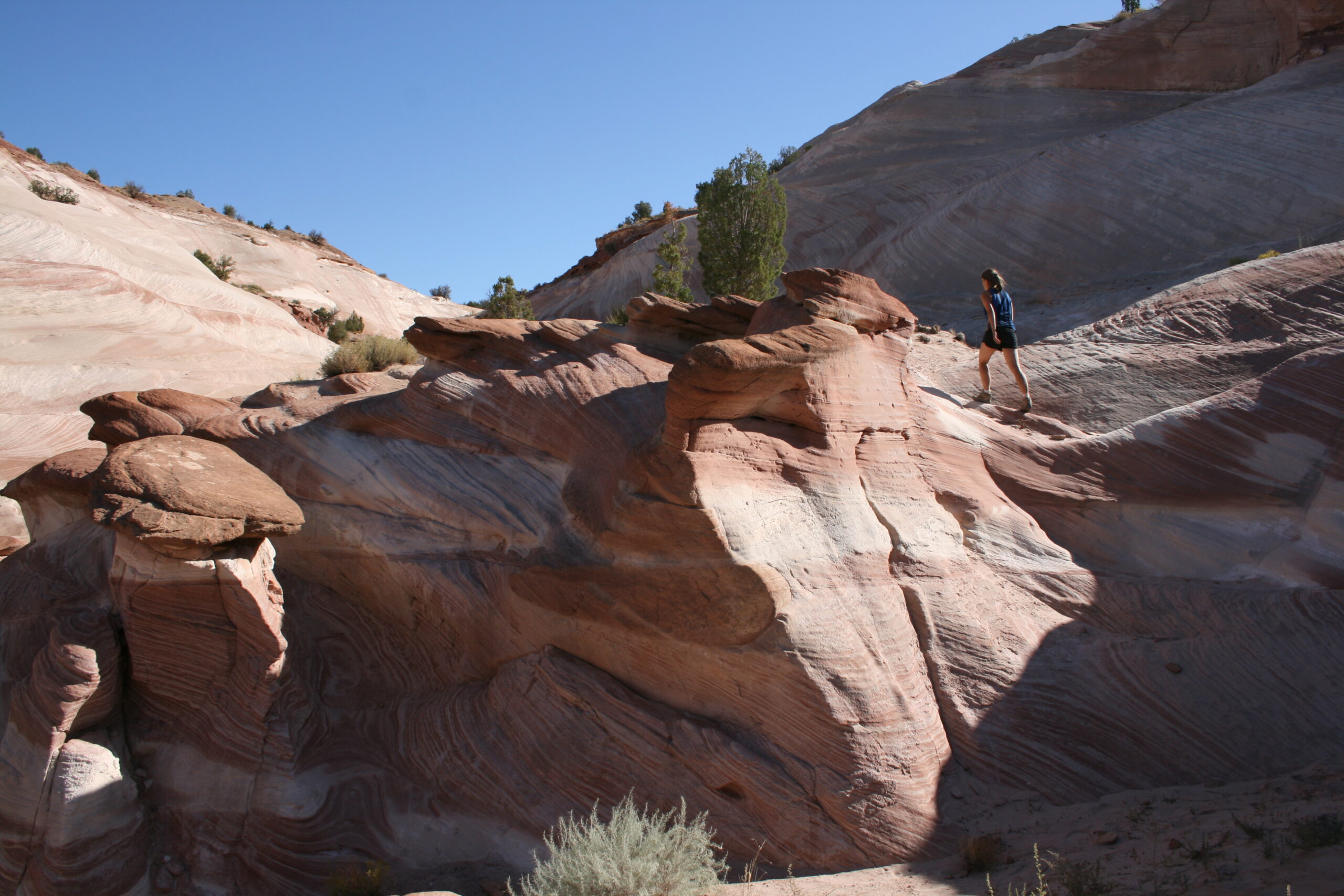
Carrying Flat Stanley, I begin scrambling up the precipitous, rocky trail and discover two sandstone ledges (known as “benches” in canyoneering parlance) protruding from the side of the canyon walls, high above the canyon floor, which will be perfect sites to pitch our tents. Rich arrives, takes one look at the steep ascent route leading to our possible campsites, and then looks at me and Wendy as though we’ve gone crazy. But after we’ve attached his backpack to a rope and dragged it up, he has no choice but to begin climbing.
We erect one of the tents on the lower bench, and then I convince Wini to let me construct our tent on the ledge above, which requires another vertical climb. But she and I manage the ascent, and we name our secluded sleeping area, The Penthouse.
Under an extraordinarily dark and starry sky, we make macaroni and cheese for dinner. Flat Stanley doesn’t seem hungry.
After gorging on blueberry cheesecake, we all lie back on our sandy benches, staring at the heavens. We’re all relieved to be the only people in the history of time to have found the Middle Route, resting safely, high above the canyon floor.
We nestle into our tents, and I place Flat Stanley carefully into my bag.
“Good night, Flat Stanley,” I say to him.
We fall asleep to the sound of wind, whistling through the canyon, lightly kissing our tents.
But at 6 A.M. the next morning, we all awake to the sound of a flash flood, rushing through Buckskin Gulch, below us.
Flat Stanley survives the Utah desert and learns Navajo
A boy made of paper, and five other hikers, traverse Buckskin Gulch’s Middle Route.
OCTOBER 4, 2009 — Because Flat Stanley is a faux child, made from poster board and crayons, his expression usually never changes. But on this morning, as he looks down on a flash flood rushing through Buckskin Gulch, perched precariously on a rock ledge, Flat Stanley somehow looks terrified. Wendy, Rich, Suzanne, Wini, and I walk as close as we’re willing to the canyon’s edge and cautiously look down at the raging river below us. We all look at each other in disbelief, without knowing what to say or do. We go quietly about our morning chores: making breakfast, packing up our sleeping bags, and disassembling our tents.
Hikers climb up sandstone formations on the Middle Route near Buckskin Gulch.
“I’m going down there to explore,” I finally announce. “Does anyone want to come?” Of course, adventurous Wendy volunteers, and the two of us climb down the slippery, sandy vertical rock comprising Middle Route and into the water. For about a quarter mile, we hike through the muddy canyon, literally testing the water. When we return to the ledges above, we report that river seems traversable, though it sometimes reached above our knees.
“But it could get a lot deeper, and we can’t see deep mud holes or sharp rocks under the water,” Suzanne says. “And what if it starts raining again?”
“I want to finish the hike,” Wendy insists.
I feel unsure. On one hand, I am confident that, if we continue hiking through the canyon, we will inevitably escape the Gulch. The water isn’t moving too fast, it’s not too deep, and we have watched the water level lower during the morning. The worst of the flood is over. On the other hand, I am afraid that even if we manage to continue safely, walking continuously through six miles of cold river water and mud will make everyone miserable. I am also aware of a log jam, about four miles ahead of us, that could turn out to be impassible due to the flood. In other situations, with more seasoned hikers, I might eagerly take such a risk, knowing that we might be forced to turn back, walking eight unnecessary miles. But we’re all here to have fun, not to prove our machismo.
The group rests above Buckskin Gulch after climbing out of the canyon.
“I will not be peer-pressured into doing this hike,” Suzanne says sharply. Wini and Rich also vote to climb out of the canyon and escape across the desert.
In my ideal world, we would spend another day camping above the canyon to wait out the flood. But we have only a one-day water supply remaining, and since the opaque flood water is saturated with mud, it doesn’t seem enticing, even filtered.
A hiker traverses Middle Route near The Dive.
Flat Stanley stays broodingly quiet, as though he’s about to make a vital, life-saving decision.
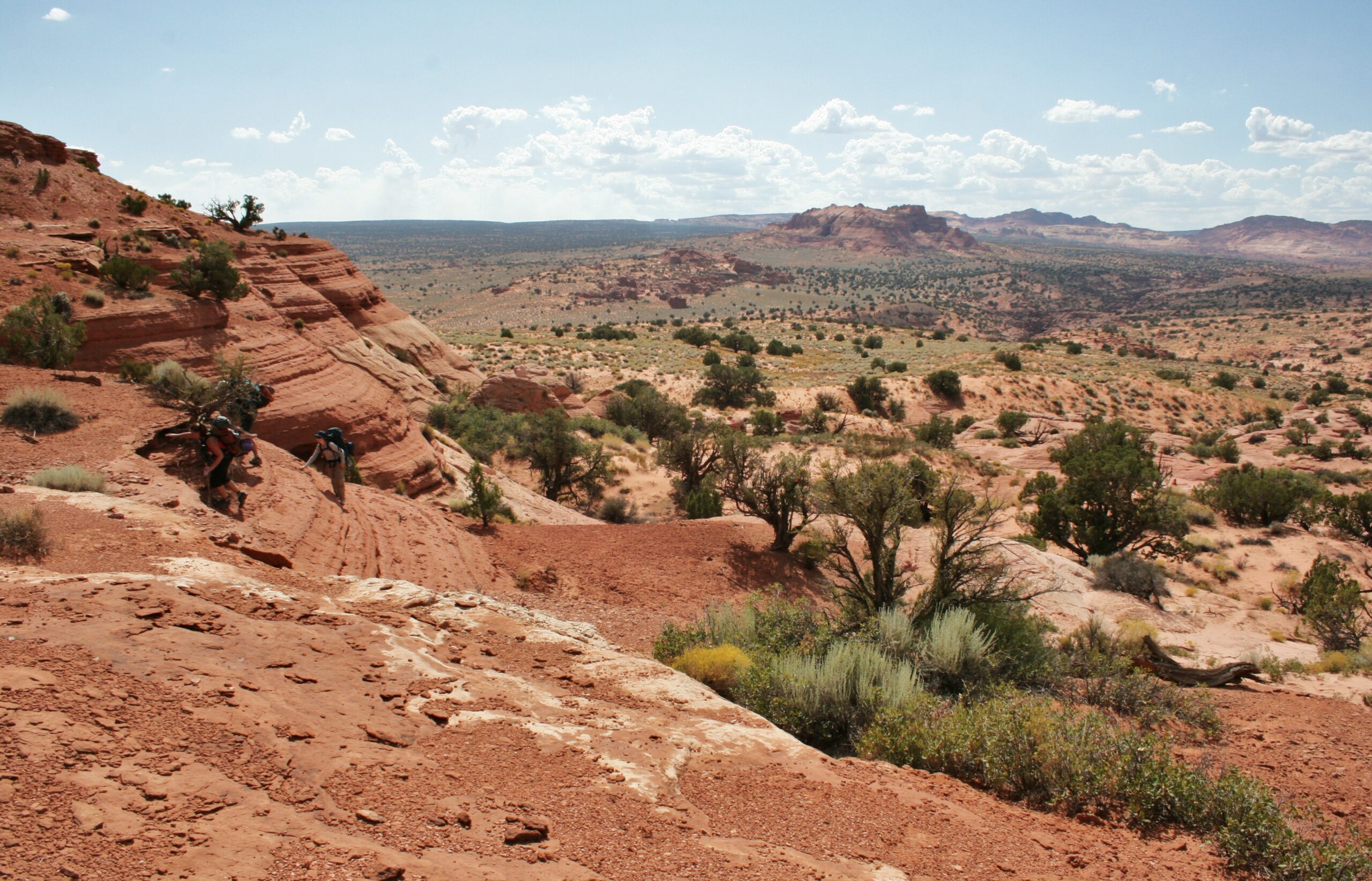
Finally, our uncertainty and the rising, hot sun make the decision for us. We reluctantly climb out of the canyon and begin making our way across the trail-less Utah backcountry, in 91-degree heat. We don’t know exactly where we’re going, which, for me, I admit, is my favorite kind of adventure. I use the topographical maps in my GPS device to find our way around The Dive, a stretch of severe, orange and red sandstone cliffs, blocking our route to the closest trailhead. Everyone in the group complains about the sizzling weather, but as I trudge along, I find myself enjoying the adventure and extraordinary views of Utah.
The Paria River flows near the White House Trailhead.
“Hank, you’re our Moses,” Suzanne remarks as she watches me lead the caravan across the scorching sand.
Though her comparison of the Red Sea to the reddish Dive seems clever, I think to myself, I’m no Moses. For one thing, as we walk, my only theology is, “Drink lots of water and wear your hat.” I also pray that I’m not like Moses, because, after all, in Exodus, Moses dies before reaching Israel. I hope to stay alive all the way to the White House Trailhead.
As the desert sun continues to boil us, Wendy sits down and tells us that she feels faint. We all stop under the shade of a tree to have a lunch of sausage and tuna burritos, and she thankfully begins to recover. For dessert, we eat the freeze-dried Neapolitan ice cream bars that I have packed. They taste like ice cream from an alternate universe, a universe where ice cream is the temperature of boiling water. It melts into a warm, gooey mess in our mouths, but, somehow, it still manages to taste like ice cream. Flat Stanley seems so nervous about our fate that he doesn’t eat a thing. But soon, we easily reach the Paria River and follow it, without incident, to the trailhead.
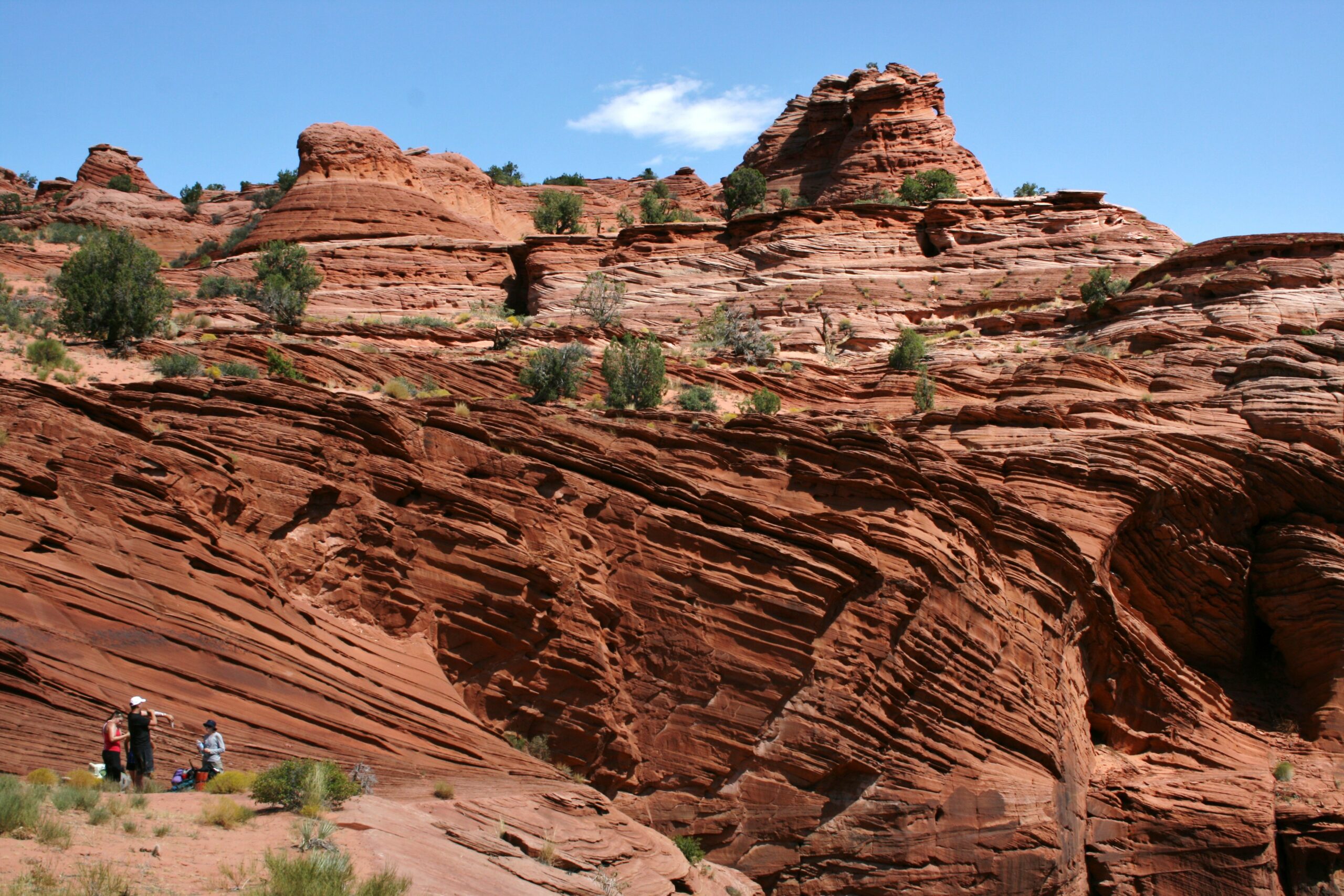
Rock formations near the White House Trailhead
Wini and I quickly convince two French tourists to drive us to a nearby town (Page, Arizona), where we then hire a man and his wife with a huge pickup truck to drive us down the long, dirt road leading to our car at the Wire Pass Trailhead. As we drive, the Native American couple entertains us by teaching us a number of useful Navajo vocabulary words. But halfway down the road, we discover yet another river (actually, the same flash flood), flowing across the road. Apparently, escaping this flood is not in my destiny, as it has made the road mostly impassible. I start to wonder if I really might share Moses’s fate. Our driver muscles his high-riding pickup truck through the water, but then he announces, “You’ll never get your car out of here.”
Wini hikes up rock formations near the White House Trailhead.
I ask him if he might be willing to help tow our car if we get stuck, and he generously agrees. But miraculously, when Wini and I get in our car and I slam the accelerator, we escape the flash flood, yet again, unscathed. Thankfully, I am not like Moses after all.
He doesn’t say so aloud, but Flat Stanley seems elated. He may be the luckiest boy made of paper in the world. After all, he is very vulnerable to water, and yet, over the past two days, he has escaped two instances of the same flash flood.
As I put him back in an envelope to send him on his next journey, I feel confident that the stories of this Flat Stanley’s adventures will be some of the most exciting in my nephew’s second grade class. Maybe, I imagine, if this Flat Stanley ever learns to talk, he’ll even impress the class by greeting them with “Ya’at’eeh” — the word for “Hello,” in Navajo.
How to Hike Buckskin Gulch
While it is possible to hike all of Buckskin Gulch, from Wire Pass to its confluence with the Paria Canyon and back, in a single day, you’ll enjoy the trip more if you give yourself more time and camp overnight. To do so, you’ll need a permit.
Visit the Bureau of Land Management Paria Canyon permit information page to learn how their permit system works.
If you can, apply for your start date up to four months in advance using the Paria Canyon Overnight Permits calendar.
The closest major airports are Las Vegas and Salt Lake City; the closest regional airports are St. George, Cedar City, and Flagstaff. Visit the Paria Ranger Station (62 miles east of Kanab, Utah) on the day before your hike to discuss the weather report, flash flood risks, and available water sources with the Ranger. You will also receive special human waste bags, because you must pack and carry out human waste. (Note: When I talked to the Ranger, she told me that there was no predicted rain. Twelve hours later, while camped above the canyon, we still experienced a flash flood. Be careful.)
Before you leave, you’ll want to park two cars, one at Wire Pass and one at your endpoint (probably White House Trailhead). If you only have one car, you may also arrange for a shuttle service by calling Betty Price at (928) 355-2552 or Paria Outpost at (928) 691-1047. These services will ask you to drive your car to your endpoint, then they will drive you to Wire Pass.
Camp that night at the Wire Pass Trailhead, 68 miles east of Kanab, Utah. You’ll need to drive 8.3 miles down a dirt road to get there, so you may prefer a high-clearance vehicle.
Start hiking in the morning, leaving immediately at dawn. For safety’s sake, carry at least eight liters of water per person, in case you don’t reach a viable water source on your first day of hiking.
If you can find it, you may choose to spend the night eight miles in, high above the canyon, at the Middle Route escape trail. You can also continue on to safe campsites at the confluence of Buckskin Gulch and the Paria Canyon, 14.5 miles from the start. Under no circumstances should you camp on the canyon floor. If you try this and a flash flood occurs, you will drown.
After reaching Paria Canyon (probably on the second day), you will have an 8-mile hike to the White House Trailhead. You may also choose to hike all the way to the Lee’s Ferry Trailhead to complete the entire length of the Paria Canyon, but allow yourself four days to do this.
View the route below or download the Without Baggage Buckskin Gulch GPS track in GPX or KML format. Note that GPS devices only work intermittently in Buckskin Gulch, and the route available for download does not cover the entire Gulch — it follows us as we escaped via the Middle Route.
Great guide! What time of the year did you go and what was the temperature like?
We went in September. In the canyon itself, the temperature was very pleasant: probably 70F. When we hiked out and across the desert, the temperature was at least 90F.
Hi. What a funny story. My mom had to carry flat Stanley around for a day for my daughters 2nd grade project. And his only adventure was to slide thru her mailbox slot, in which, her cat promptly sniffed him, and batted him around like a toy… My husband and I will be going to Buckskin. I am scared to death. We are not in shape. I can not swim. And I hope we can fit thru the narrow areas. Any suggestions??? He is bound and determined to go.
Keep updating all of us.
Buckskin Gulch is a good p0lace to visit to have a fun time. I like its natural beauty and rock formation. I have been there once and backpacking is my favorite to enjoy there.